 |
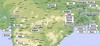
Map of the North and Central parts |
 |
A map |
Photo Collection
Places
India
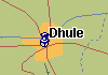
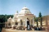
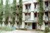
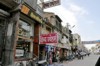
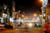
Dhula (Dhule)
26 January 1908 Sri Aurobindo gives a speech at Dhula.
Maps
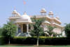
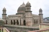
Other photos
 |
 |
 |
 |
 |
 |
 |
 |
 |
 |
 |
 |
 |
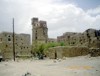
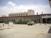
Dhule is a city in northwestern state Maharashtra of India. It is the administrative headquarters of Dhule District. It is situated along banks of Panzara river. Latitude 20°.54' N, longitude 74°47'. Population of city: (1991) 278,317; (2001) 333,980. Major languages: Hindi (official), English, Tamil. Majority of the population in the rural area speaks Ahirani (a dialect of Marathi) language, however Marathi is more widely spoken in the urban areas.
Dhule became part of the Mughal Empire in 1601, during the reign of Akbar. In the 18th century Dhule came under Maratha rule. In 1818, Dhule was annexed by the British, and was included in the Bombay Presidency. Dhule city is a well planned city, and it's believed that it was planned by Capt. James Briggs. After Indian independence in 1947, Bombay Presidency became Bombay State, which in 1960 was divided along linguistic lines into the new states of Maharashtra and Gujarat.
Places of worshipping are Ekvira mandir, Swaminarayan mandir, Gurudwara, Church and Masjids. Dhule city is famous for its quality education institutes. Recently new sports stadium is constructed in Dhule city.
The nearest international airport is Mumbai and Pune. Dhule has its own domestic airport at Gondur. Three major highways passes through Dhule city. Rail link between Dhule and Chalisgaon junction connects Dhule to Central Railway of India.
It is a center for cotton-textile manufacturing, with both spinning and weaving operations. Agriculture remains the basic profession of the population in this district. Onion & cotton are the premier crops, farmers harvest.