 |
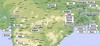
Map of the North and Central parts |
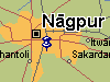 |
A map |
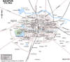 |
A map |
Photo Collection
Places
India
Nagpore (Nagpur)
On 22 December 1907, Sri Aurobindo — at a meeting at Nagpore.
On 30-31 January 1908, Sri Aurobindo gave a speech at Nagpore.
On 30 August 1920, letter to V.S. Munjee — denial of offer to chairman at a congress at Nagpore.
Maps
|
Map of the North and Central parts |
|
A map |
|
A map |
Photos
 |
 |
 |
 |
 |
 |
 |
 |
 |
 |
 |
 |
 |
 |
 |
 |
 |
 |
 |
 |
 |
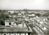 |
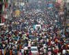
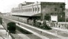
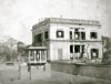
Nagpore (Nagpur) city, northeastern Maharashtra state, western India. It lies along the Nag River and is situated almost at the geographic centre of India. The present city was founded in the early 18th century by Bakht Buland, a Gond raja. It became the capital of the Bhonsles of the Maratha confederacy but in 1817 came under British influence. In 1853 the city lapsed into British control and in 1861 became the capital of the Central Provinces. The advent of the Great Indian Peninsula Railway in 1867 spurred its development as a trade centre. After Indian independence, Nagpur was briefly the capital of Madhya Pradesh state until 1956, when what is now Maharashtra state was created.
The growing of cotton in the region about the time of the construction of the railway led to the establishment of a large textile mill and signaled the development of the city as an important industrial centre. Since that time Nagpur's industrial complex has diversified considerably and in the 1970s expanded to absorb the nearby town of Kamptee, with its factories that produce ferromanganese products, transport equipment, and other metal goods. Situated at the junction of road, rail, and air routes from Bombay to Calcutta and from Madras to Delhi, Nagpur has developed a flourishing trade.
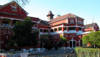
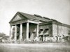
Nagpur is dominated by the British fort built on the twin hills of Sitabuldi, in the centre of the city. An educational and cultural centre, Nagpur has a large museum specializing in local exhibits and is the site of the University of Nagpur (1923), which has numerous affiliated colleges in the city.
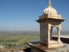
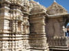
The surrounding region is an undulating plateau rising northward to the Satpura Range. In the northeast are the Ramtek Hills, site of a temple at Ramtek that draws many pilgrims to its sacred annual festivals. Interspersing the hills are two major rivers--the Wardha (west) and the Wainganga (east)--both tributaries of the Godavari. The region is important agriculturally; jowar (sorghum) and cotton are major crops. The region is especially known for its oranges, which are shipped all over India. Extensive coal and manganese deposits support growing industry. Pop. (1991 prelim.) city, 1,622,225; metropolitan area, 1,661,409.