 |
 |
 |
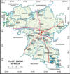 |
Photo Collection
Places
India
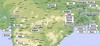
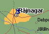
Sylhet
September 1909, Sri Aurobindo at Sylhet on meeting of Nationalists.
Maps
|
|
|
|
Photos
 |
 |
 |
 |
 |
 |
 |
 |
 |
 |
 |
 |
 |
 |
 |
 |
 |
 |
 |
 |
 |
 |
 |
 |
 |
 |
 |
 |
 |
 |
 |
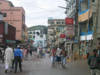
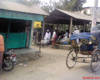
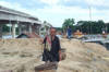
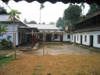
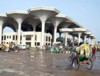
Sylhet, originally Srihatta, city, northeastern Bangladesh. It lies along the right bank of the Surma River. Sylhet Sadar (Town) consists of 27 wards and 210 mahallas. The area of the town is 10.49 sq. km. Population (1991) city, 114,284; now (2000-2005) 285,308; male 54.68%, female 45.32%. Literacy rate among the town people is 66.9%. Administration Sylhet thana, now an upazila, was established in 1878. The upazila consists of one municipality, 23 union parishads, 84 mouzas and 689 villages. Population 554412; male 52.51%, female 47.49%; Muslim 91.26%, Hindu 7.43%, Buddhist, Christian and others 1.31%; ethnic nationals: Khasi and Monipuri and Patra caste.
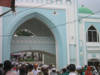
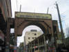
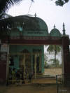
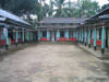
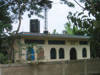
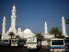
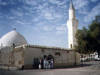
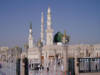
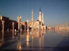
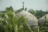
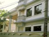
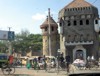
Archaeological heritage Stone inscription of the tomb of shah jajal (r), Ghardoar Nawabi Mosque, statue made of kasti pathor (touchstone) at Bishwamvar Akhra, stone inscription of Shahi Eid-gah, Kreen Bridge. Marks of War of Liberation Mass killing site: Sylhet Cadet College, Civil Surgeon's Bungalow, Laltila, Uriatila, Khadimnagar and Sheikh Burhanuddin Road; mass grave: Zindabazar, Police Line, Malnichara Tea Garden, Cadet College and Sallatikar; memorial sculpture at Jalalabad Cantonment. Religious institutions Sheikh Sunaullah Mosque, Nababi Mosque, Dargah Mosque, Kudratullah Mosque, Shahparan Mosque, Abu Turab Mosque; Shib Mandir of Gotatik, Kalighat Kali Mandir, Sath Sanga Vihar, Ramkrisna Mission and Math, Volanandagiri Ashram; Presbyterian Church (1897), church at Nayasarak, Surma Market Church; tombs of Hazrat Shah Jalal (R), Hazrat shah paran (r), Garam Dewan, Madhu Shahid, Panch Pir, Zindah Pir; Satir Pithasthan and Jainpur Pithasthan are two notable sacred places. Noted educational institutions: Sylhet Government Pailot High School (1836), Raja Jimi High School (1886), MC College (1889), Sylhet Sanskrit College (1902), Sylhet Government Agragami Girl's High School ((1903), Model High School (1932), Government Madan Mohan College (1940), The Aided High School (1942), Kishori Mohan Girls' School (1944), Sylhet Government Aalia Madrasa (1948), MAG Osmany Medical College (1975), Sylhet Cadet College, Shahjalal University of Science & Technology (1987). Cultural orgainisation Public library 2, museum 3, cinema hall 8, theatre stage 2, theatre group 2, women's organisation 2.
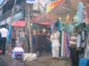
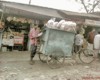
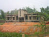
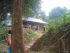
Main occupations Agriculture 16.84%, fishing 1.99%, agricultural labourer 10.59%, wage labourer 5.08%, commerce 21.48%, transport 4.62%, construction 2.92%, service 15.23%, others 21.25%. Main crops Paddy, tea, potato, brinjal, patal, onion, garlic, betel leaf. Main fruits Pineapple, orange, pomegranate, lemon, katbel (elephant apple). Fisheries, dairies, poultries Fishery 25, poultry 70, hatchery 10. Communication facilities Roads: pucca 56 km, semi pucca 8 km and mud road 375 km; railways 49.07 km. One airport, recently it has been upgraded to international status. Manufactories About 50 manufactories including textile mills, ice factories, flourmills, etc. Cottage industries Weaving 50, bamboo and cane work 300, goldsmith 1000, blacksmith 200, potteries 700, wood work 800, tailoring 2000, bidi factory 5, welding 50. Mineral resource natural gas. Main exports Natural gas, tea, betel leaf, orange, dry fish, Manipuri handloom products, bamboo & cane furniture, shital pati.